Foto Album Mountainbike Touren Schweiz:
Tessin Zentralschweiz Graubünden Wallis Uri Schwyz Nidwalden Obwalden Bern Glarus St.Gallen Zürich
Benutzerdefinierte Suche
Startseite
Kontakt
Registrieren
Anmelden
Trail Fotos Mountainbike Touren Bilder
Trail photo album Mountainbike Touren
Forum
Albenliste
Neueste Uploads
Neueste Kommentare
Am meisten angesehen
Am besten bewertet
Meine Favoriten
Suche
Galerie
>
Trail
>
Zentralschweiz
>
Maighelspass
Datei 7/40
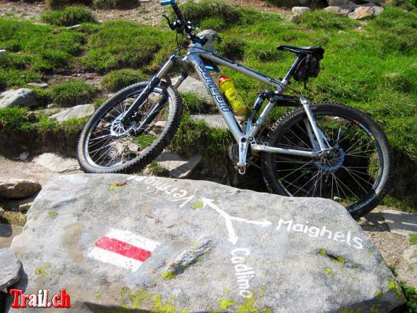
Wo geht's denn weiter? Wegweiser Richtung Maighelspass
Navigation auf Granit
Wozu den GPS wenn's so einfach geht...
Der Wegweiser Richtung Maighelspass.
Maighelspass
Diese Datei bewerten
(noch keine Bewertung)
Datei-Information
Dateiname:
maighels-lutersee_img_1867_29-07-2009.jpg
Name des Albums:
RedOrbiter
/
Maighelspass
Schlüsselwörter:
Navigation
/
Val
/
Maighels
/
Surselva
/
SAC
/
Oberalp
/
Maighelspass
/
Andermatt
/
Unteralptal
/
Urserental
/
Graubünden
/
Uri
/
Vermigel
Dateigröße:
211 KB
Hinzugefügt am:
31. Juli 2009
Abmessungen:
1000 x 750 Pixel
Angezeigt:
1170 mal
URL:
https://www.trail.ch/gallery/displayimage.php?pid=830
Favoriten:
zu Favoriten hinzufügen
BBCode:
[url=https://www.trail.ch/gallery/displayimage.php?pid=830][img]https://www.trail.ch/gallery/albums/trail/zentralschweiz/maighelspass/thumb_maighels-lutersee_img_1867_29-07-2009.jpg[/img][/url]
Füge Deinen Kommentar hinzu
Anonyme Kommentare sind hier nicht erlaubt.
Melde Dich an
, um einen Kommentar abzugeben
this website is part of
www.trail.ch
by RedOrbiter
[
Home
] [
Touren
] [
Forum
] [Foto-Galerie] [
GPS
]